Surveying dunes with new infrastructure
23 01 2023
Category: Geography, IDUB research infrastructure
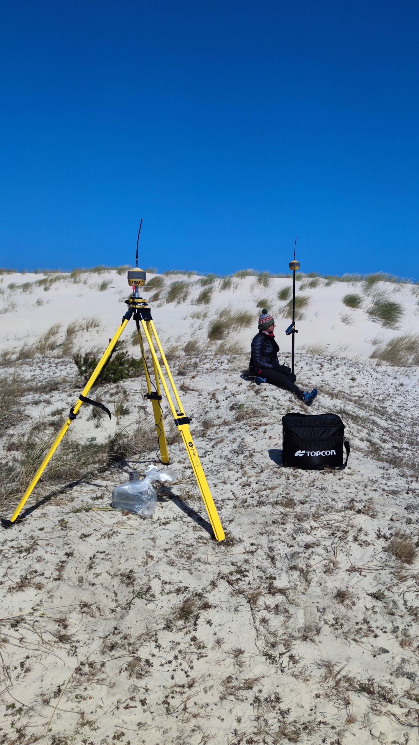
A team from the Faculty of Geography and Regional Studies is surveying the land surface in areas without internet access. They are using a high-precision GPS RTK system purchased with IDUB funds.
The leader of the project under which the infrastructure was purchased is Professor Maciej Dłużewski from the Faculty of Geography and Regional Studies. For the purchase of the equipment, he received 67,000 zlotys from the IDUB I.4.2 action „Fund for the renovation and development of research infrastructure”, implemented as part of the Priority Research Area II „Beyond Micro and Macro Worlds”.
High-precision surveying without internet access
GPS RTK technology uses satellite systems to precisely locate a point on the ground. It is used by geodesists, geologists and archaeologists, but also by engineers, for example in highway construction.
The devices operate in a base-rover system, which means that two receivers communicate with each other via radio waves. Such a system makes it possible to carry out measurements in areas without access to a traditional positioning correction network (usually transmitted via GSM), and thus to carry out surveys in areas far from the modern comforts of civilisation (the Internet).
Such a system is also very precise. If the measurement is carried out in good conditions, i.e. in an open space with nothing obstructing the receivers, the measurement precision can be as high as 1 cm, both horizontally and vertically.
The decline of dunes in Poland
Professor Dłużewski’s team is currently working in the area of the Słowiński National Park, where they are analysing trends in changes in the position of the coastline and the degradation/development of frontal dune shafts. Surveys, carried out using GPS RTK and other techniques, show that in some places in the park, the Polish coastline has been eroded by more than 100 metres in just 10 years. Scientists use GPS RTK to regularly monitor the surface of the beach and dunes, which allows them to analyse changes in their volume. The data obtained allow researchers to determine the rate of development and degradation of frontal dunes, thereby identifying the causes of coastal destruction and forecasting changes in the position of the coastline. This information is needed, among other things, to protect the dunes in Poland, which provide a natural barrier against storm waves during extreme hydro-meteorological events, which are expected to become more frequent and intense as a result of climate change. Due to the lack of GSM network coverage in most of the SNP area, it is necessary to use the GPS RTK base rover system to make precise measurements.
Measurements in the desert
Another area without GSM coverage is the Sahara, where Prof. Dłużewski has been studying the shape of different types of dunes for many years, analysing the dynamics of their development and the speed at which they move. Such information not only contributes to science but also provides valuable information for local authorities, allowing them to determine, for example, how quickly a particular dune will cover a village, an oasis or a road.
Pioneer research
Professor Dłużewski is a pioneer in this type of research. He has carried out a record number of dune measurements in various desert regions around the world, and his team is one of the few in the field of geography and geomorphology to use this method on such a large scale. This is because researchers are usually restricted to areas where there is GSM coverage, which allows them to take measurements with a single receiver.
The system requires a certain amount of knowledge, not only in terms of geodetic surveying but above all in the field of eolian geomorphology. Not only do you need to know how to operate the equipment, but also how to analyse and interpret the results of the measurements. Fortunately, Professor Dłużewski has many years of practical experience in this field and is passing on his knowledge to the next generation of researchers.
Collaboration is key
Professor Dłużewski’s team collaborates with the Słowiński National Park and several universities in Poland and beyond. Specialists from different universities work in the same area, often complementing each other, consulting on research problems and publishing scientific papers together. The same applies to North Africa, where both local and Polish researchers are cooperating.
The infrastructure is also used by undergraduate and postgraduate students, resulting in master and doctoral theses. One of the doctoral theses, carried out in the Sahara, has been awarded in prestigious competitions for the best doctoral thesis in geography and geomorphology in Poland.
The team is open to new collaborations. Contact details and a technical description of the infrastructure can be found here.